E4 Trail in Rila
Е4 в Рила
The long-distance trail across Rila is a serious mountain route rather than a casual day hike. It matters in a national catalogue because it connects the highest and most rugged parts of the massif. [2][6]
The long-distance trail across Rila is a serious mountain route rather than a casual day hike. It matters in a national catalogue because it connects the highest and most rugged parts of the massif. [2][6]
When to go.
A per-season read on whether E4 Trail in Rila is at its best, simply open, or worth skipping. Confidence reflects research depth.
Snowpack above 2000m persists into May; several E4 passes remain avalanche-prone and poorly marked.[1]
Continuous snow-free conditions usually mid-July–early September; huts open and days long for multi-stage trekking.[1]
Early September still good; by late October early snowstorms and frosts complicate higher segments and huts close.
High ridgelines and passes are loaded with windblown snow and serious avalanche risk December–March.
How to reach it.
- Region
- Rila
- Type
- hike
- Coordinates
- 42.1700, 23.4550
E4 Trail in Rila in place.
Topographic base with hiking trails on the tiles themselves. Nearby destinations in Rila appear as faded markers - click any to jump there.
In the same region.
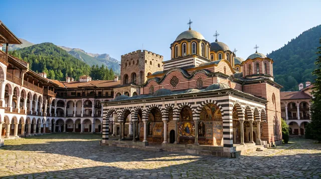
Rila Monastery
Rila Monastery is Bulgaria’s largest Eastern Orthodox monastery and a UNESCO World Heritage Site, framed by steep forested slopes.[3][6][7] Visitors enter a fortress-like courtyard of striped arcades and vivid frescoes, with a small museum and short paths to nearby viewpoints. Weekends and holidays can be busy with tour buses, but early mornings retain a quieter devotional atmosphere.
Scenic 97 / 100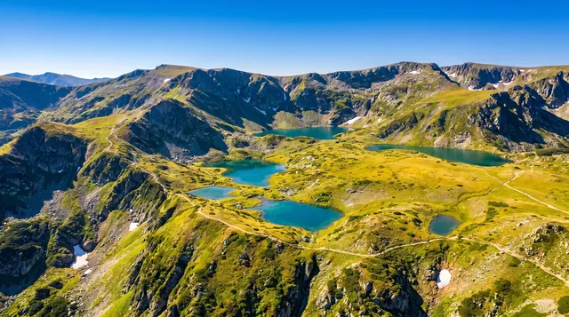
Seven Rila Lakes Circuit
The Seven Rila Lakes circuit links a chain of glacial lakes in a high basin above the Sapareva Banya side of Rila, reached by a summer chairlift.[2][3] Trails circle the lakes and climb to viewpoints over the whole amphitheater, with options ranging from short loops to a full 12–13 km circuit. Crowds and erosion are noticeable in peak season, so early starts help preserve some quiet.
Scenic 96 / 100Musala
Bulgaria’s highest peak and a core calibration anchor for alpine scenery. The ascent is a high-mountain experience with broad views over the Rila Massif and beyond. [1][2]
Scenic 95 / 100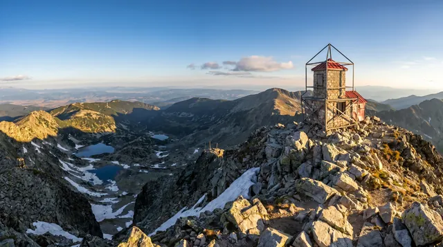
Musala Peak
Musala is the highest summit in Bulgaria and the Balkans, rising above the Borovets ski area with broad views across Rila, Pirin and the Rhodopes.[1][3] Most hikers approach via the Yastrebets gondola and the Musala Hut route on marked red-white trails. Expect rocky alpine terrain, rapidly changing weather and lingering snowfields in early summer.
Scenic 95 / 100