
Cape Kaliakra
Нос Калиакра
A narrow limestone headland projecting deep into the sea, edged by 60–70 m cliffs and exposed to constant wind.[3] Remains of fortifications, gate walls, and a small chapel line the access path along with memorials to local legends. Dolphins and cormorants are occasionally seen below the cliffs on calm days.
A narrow limestone headland projecting deep into the sea, edged by 60–70 m cliffs and exposed to constant wind.[3] Remains of fortifications, gate walls, and a small chapel line the access path along with memorials to local legends. Dolphins and cormorants are occasionally seen below the cliffs on calm days.
When to go.
A per-season read on whether Cape Kaliakra is at its best, simply open, or worth skipping. Confidence reflects research depth.
March–May offers wildflowers, migrating birds, and manageable winds along the exposed fortress promontory.[3][5]
Sea breezes help, but midday July–August sun and tour coaches create crowding on narrow paths.[3][5]
Clear views and pleasant 15–23°C temperatures in September–October pair with lighter visitor numbers.[3][5]
Access road usually open; however, strong winds and cold spray make extended stays uncomfortable.[5]
How to reach it.
- Region
- Black Sea
- Type
- fortress
- Nearest town
- Kavarna
- Access
- Reached by paved road from Kavarna; final stretch is narrow with a car park near the cape entrance.
- Duration
- 1.5–3h walk and exploration
- Difficulty
- easy
- Distance
- 3 km
- Elevation
- 60 m
- Crowds at peak
- medium
- Coordinates
- 43.3617, 28.4672
Cape Kaliakra in place.
Topographic base with hiking trails on the tiles themselves. Nearby destinations in Black Sea appear as faded markers - click any to jump there.
In the same region.
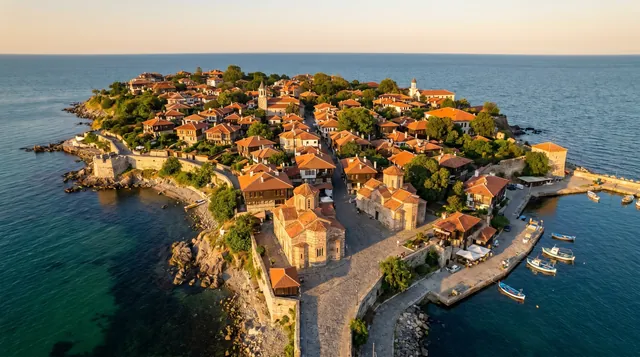
Old Town Nessebar
Nessebar’s old peninsula is one of Bulgaria’s most famous heritage landscapes and a UNESCO-listed urban ensemble. The setting on a narrow sea edge gives it more photogenic power than a typical historic town.
Scenic 95 / 100Nessebar Old Town (UNESCO)
Narrow peninsula linked by a causeway, packed with medieval churches and Black Sea merchant houses.[3] The UNESCO-listed core preserves city walls, lanes, and seaside promenades with constant views of the water. Tourist stalls are intrusive in season, but early and late hours still feel atmospheric.
Scenic 92 / 100Cape Emine
Wind-exposed promontory marking the conventional boundary between the northern and southern Bulgarian Black Sea coast and the end of the E3 Kom–Emine trail.[7] Steep slopes drop to rocky inlets and remnants of military installations, while a lighthouse and small chapel sit above. Access tracks can be rough, and in bad weather the cape feels very isolated.
Scenic 90 / 100Balchik Palace & Botanical Garden
Former Romanian royal seaside residence with terraced gardens descending towards a rocky shore.[2][3] The complex blends Mediterranean and Balkan elements, including chapels, towers, and dense plant collections. Narrow alleys, seafront terraces, and the adjacent small harbour give many composed viewpoints over the bay.
Scenic 89 / 100